|
Mt Whitney Solo Day Hike 2013 |
I've wanted to hike Mt Whitney for
years, but have never bothered to enter the lottery to get a permit to
hike it. In late 2012, a friend from work hiked Whitney and
posted pictures, which finally proded me into entering the lottery in
Feb 2013. You can specify the date you want to hike, along with
up to 14 alternate date. Kent, Ray, and Paul all talked about
hiking Whitney, but they didn't enter the lottery. I won one of
my alternate dates - Tuesday August 20, 2013. When I notified
everyone I had won permits, their excitement dropped dramatically when
they found out my permit was for mid-week. Worse, I started a new
job the first week of August, and decided I probably wouldn't be able
to hike, so any remaining interest from my freinds died at that
point. I finally decided that I spend plenty of time at work, but
if I forfeited my dream of hiking Whitney for work I would regret
it. At the last minute, I flip flopped and decided to
hike.
I live at sea level. I figure I had
no chance of
going from sea level to 14,505 feet in under 48 hours and successfully
hiking 22 miles. I had decided that I would
try to climatize at
altitude for two nights prior to the hike - one night in Tuolumne, and
another night at Whitney Portal. I was able to secure
camping permits for both nights. I got one of the last available
permits for Whitney in the spring, and was able to find a permit for
Tuolumne later in the summer.
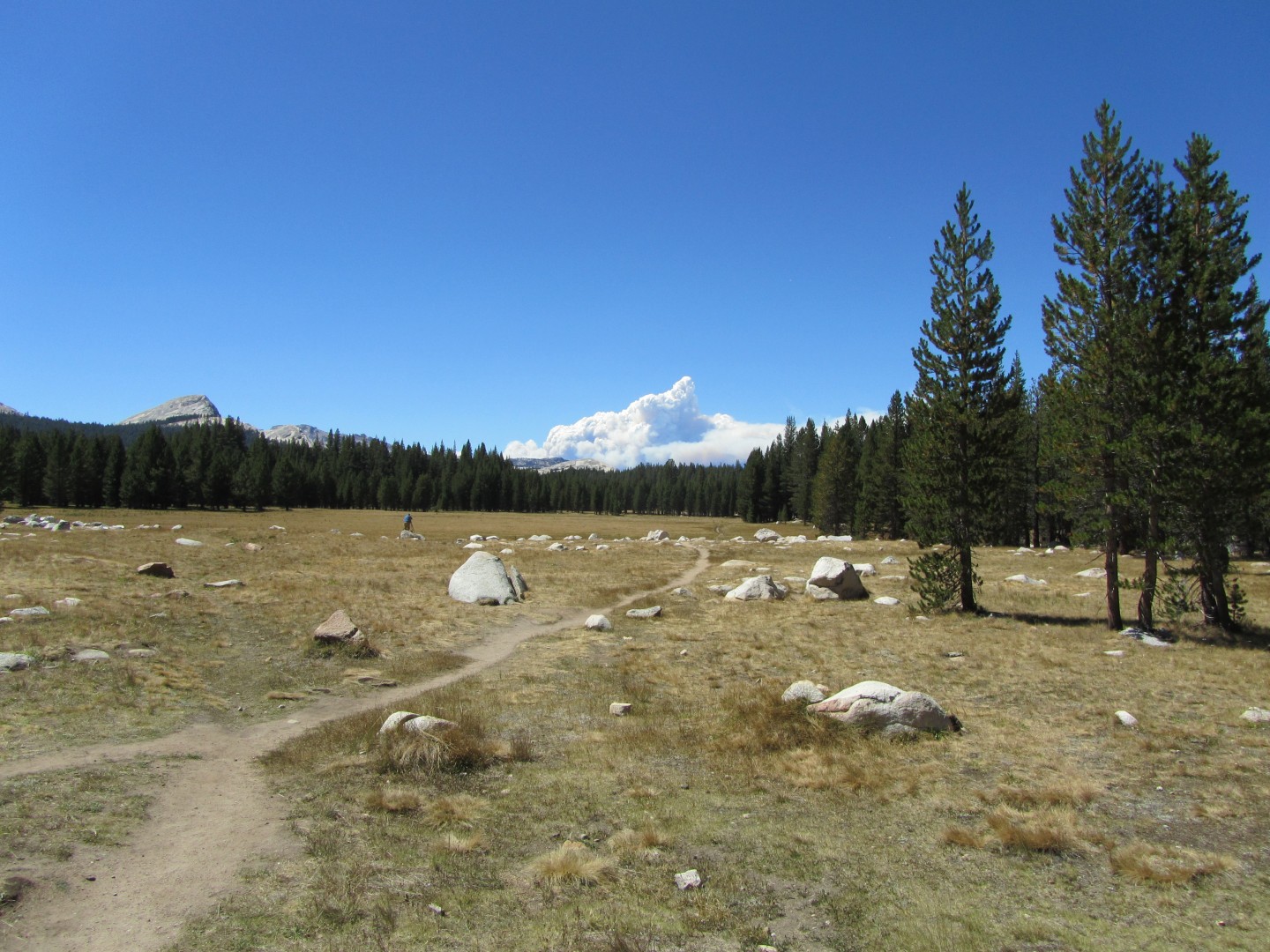
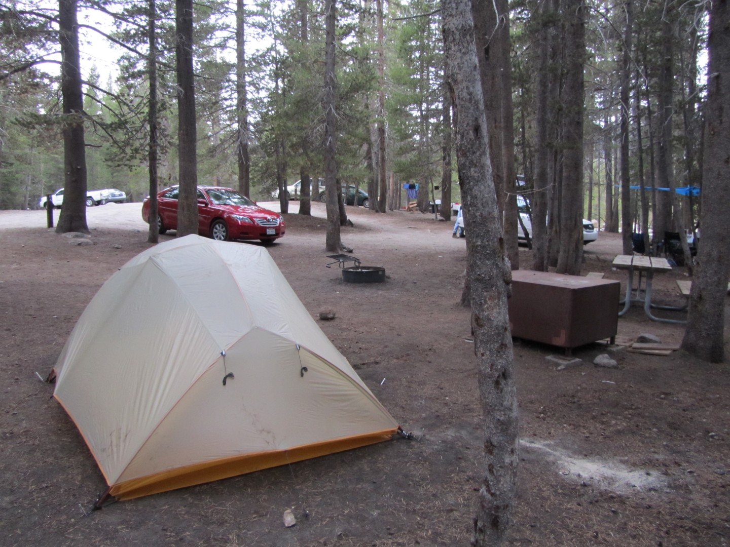
I left home Sunday morning August
18, taking Kathy's Camry because my beloved 99 Celica was stuck in the
shop waiting for a part to replace its 5th gear - it ended up taking
nearly two weeks to get the car back. I drove to Tuolumne Meadows
and set up my tent.
I wanted to spend the afternoon at Tenaya Lake, one of the best spots to relax on earth. The weather didn't cooperate - it rained briefly right as a pulled into the parking lot at the lake. I forged ahead and set up my chair lakeside after the rain died down, but the sun never came back out and the wind was just cool enough to make picnicing unpleasant. I gave up within 45 minutes or so and drove back to Tuolumne.
My other big plan for the Sierras is
to complete the John Muir Trail, one segment at a time. On August
6, 2009 I hiked from Tuloumne Meadows campground to Upper Pines in the
Valley. Sunday evening I took the bus to the Visitor Center, then
hiked the JMT between the Visitor Center and the Lembert Dome parking
lot via Sode Springs. One more small segment completed.
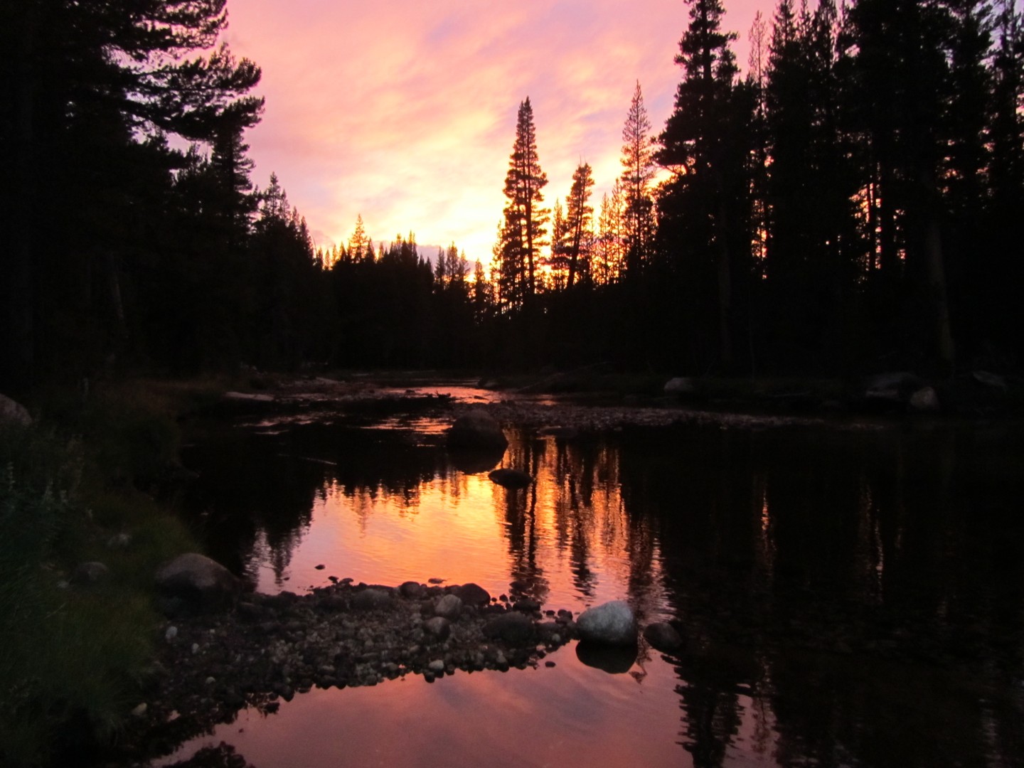
Dusk at the Merced
River was gorgeous
Monday morning I packed up, drove to
Tuloumne Meadows
Lodge, took a shower, hiked back to the Lembert Dome parking lot, then
took the bus back to my car.
One more small segment of the JMT completed - I
had now hiked (in segments) the complete trail between the Valley and Tuloumne Meadows Lodge.
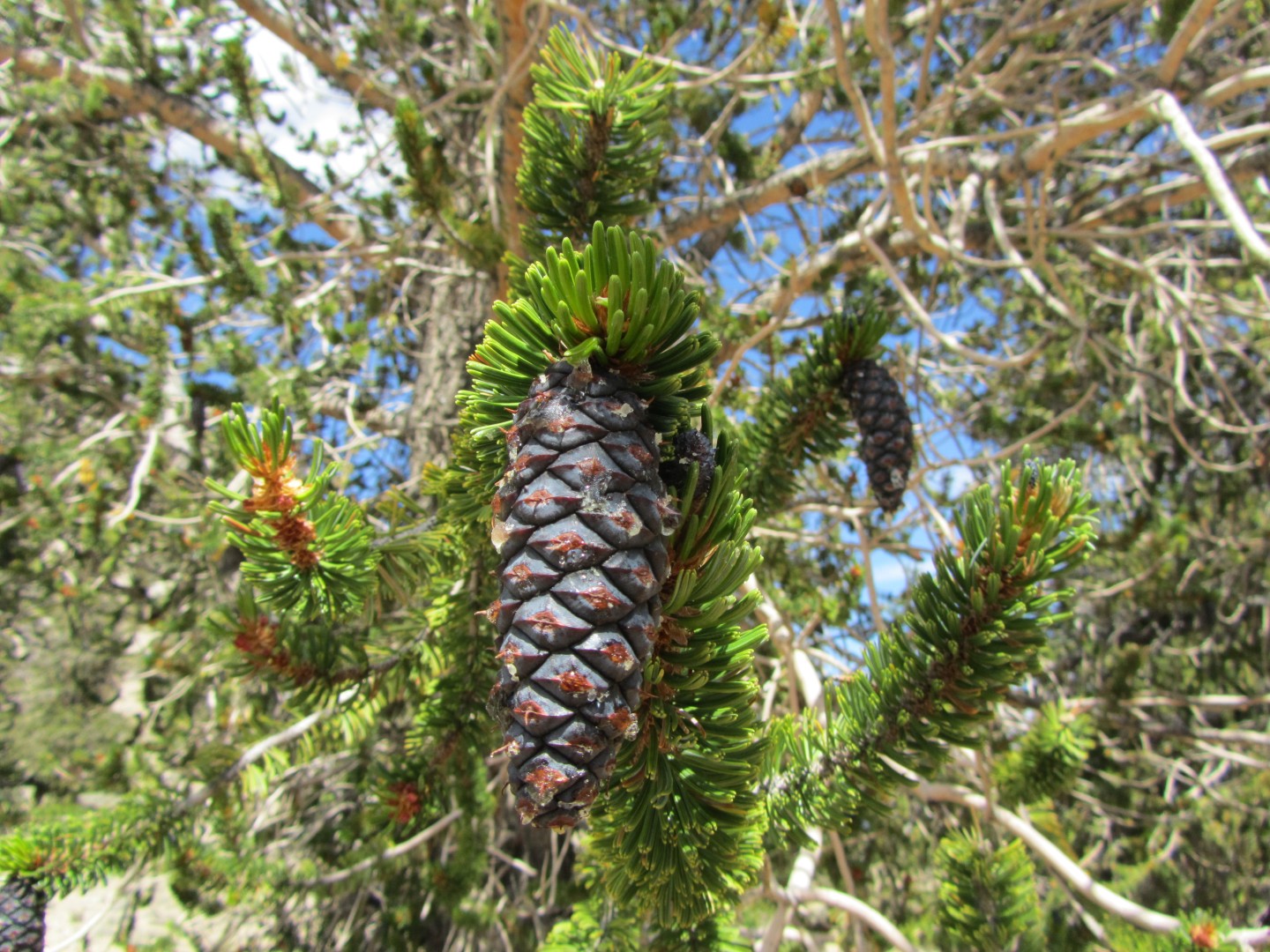
Another long term goal of mine was
to see the Bristlecone Pines, the oldest living things on earth.
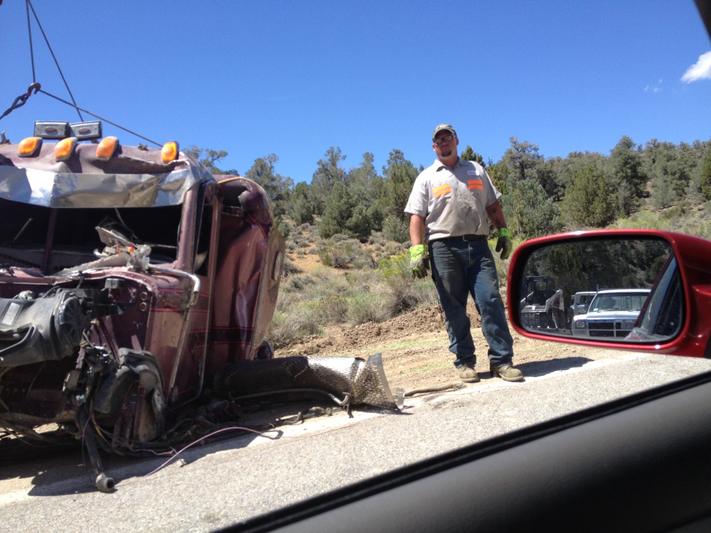
Monday would be the day. I drove to Big Pine, turned the drive up
Highway 168 into the mountains... and was stopped by a Highway Patrol
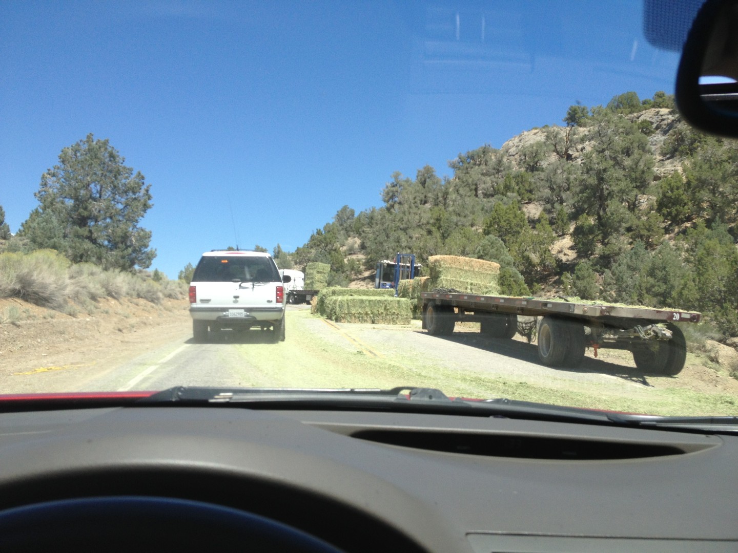
at a roadblock about a mile up the road. A double hay truck had
overturned up in the mountains spilling hay all over the road and
closing it. Crews were busy cleaning up the mess and towing what
was left of the truck. The officer advised to check back in an
hour or so. This presented a problem. It was noon, and I
had to pick up my hard won Whitney permit by 5pm in Lone Pine, about 45
minutes to the south. I went into Big Pine and had a sandwhich
from one of the small grocery stores. I called the Visitor Center
in Lone Pine to see what arrangements could be made for a late permit
pickup. They said they would place my permit in their overnight
box and told me how to access the box. The Ranger I spoke with
said she had been on Whitney the day before and had been in a very
serious thunderstorm.
After lunch I went back to the roadblock. By this time traffic was coming down the road, and the officer said the road would be opened soon, but the officer still wouldn't let me go up the road. Within another 10 minutes he relented and let me drive into the mountains. The hay truck mess was quite a sight.
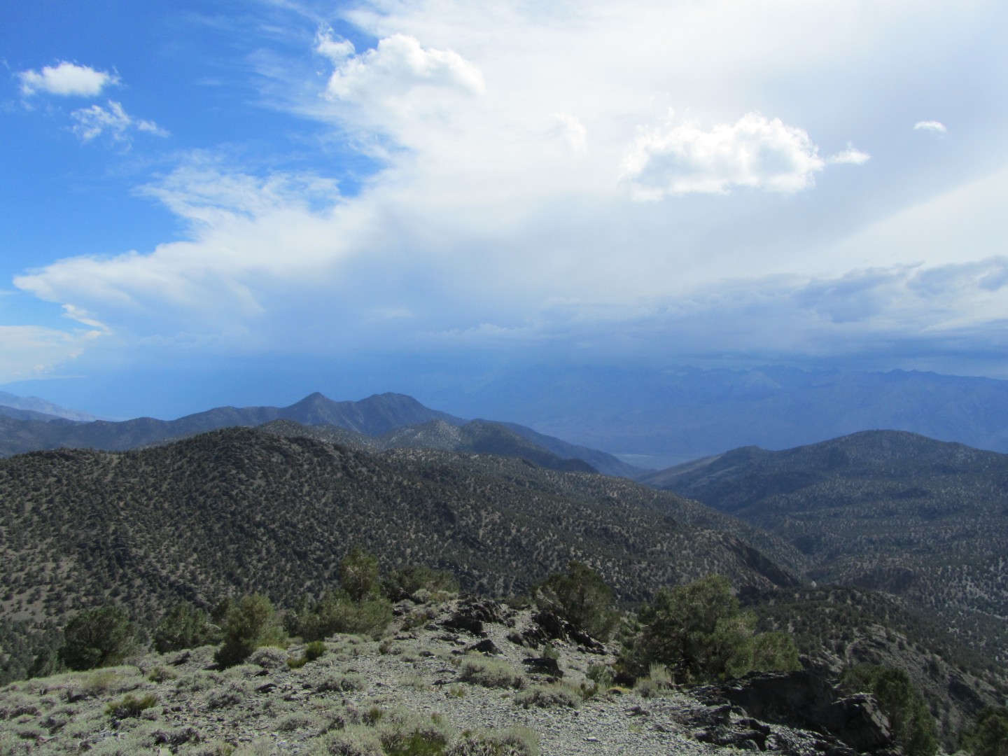
I stopped at a few overlooks on the way to the Ancient Bristlecone Pines Visitor Center. It was storming over the Sierras, and it looked awful over Whitney.
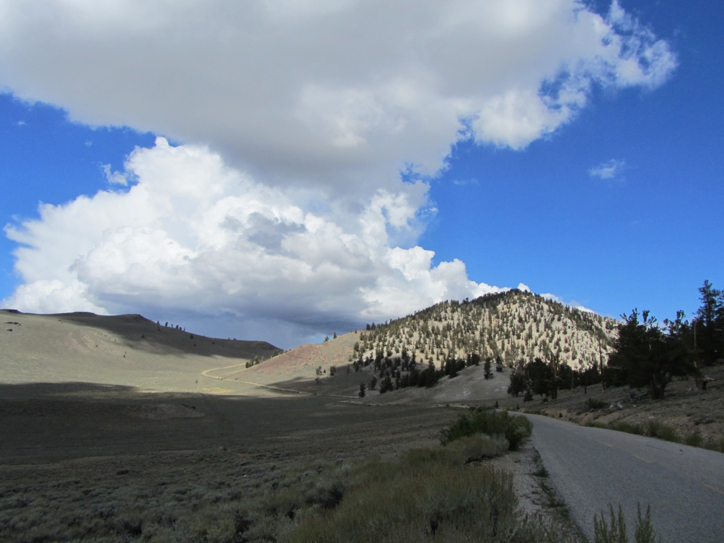
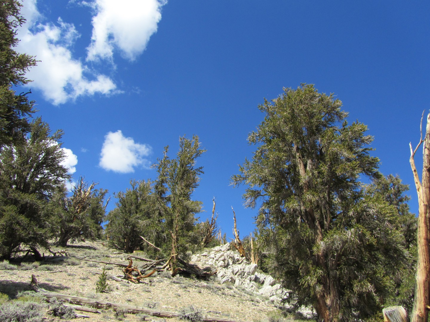
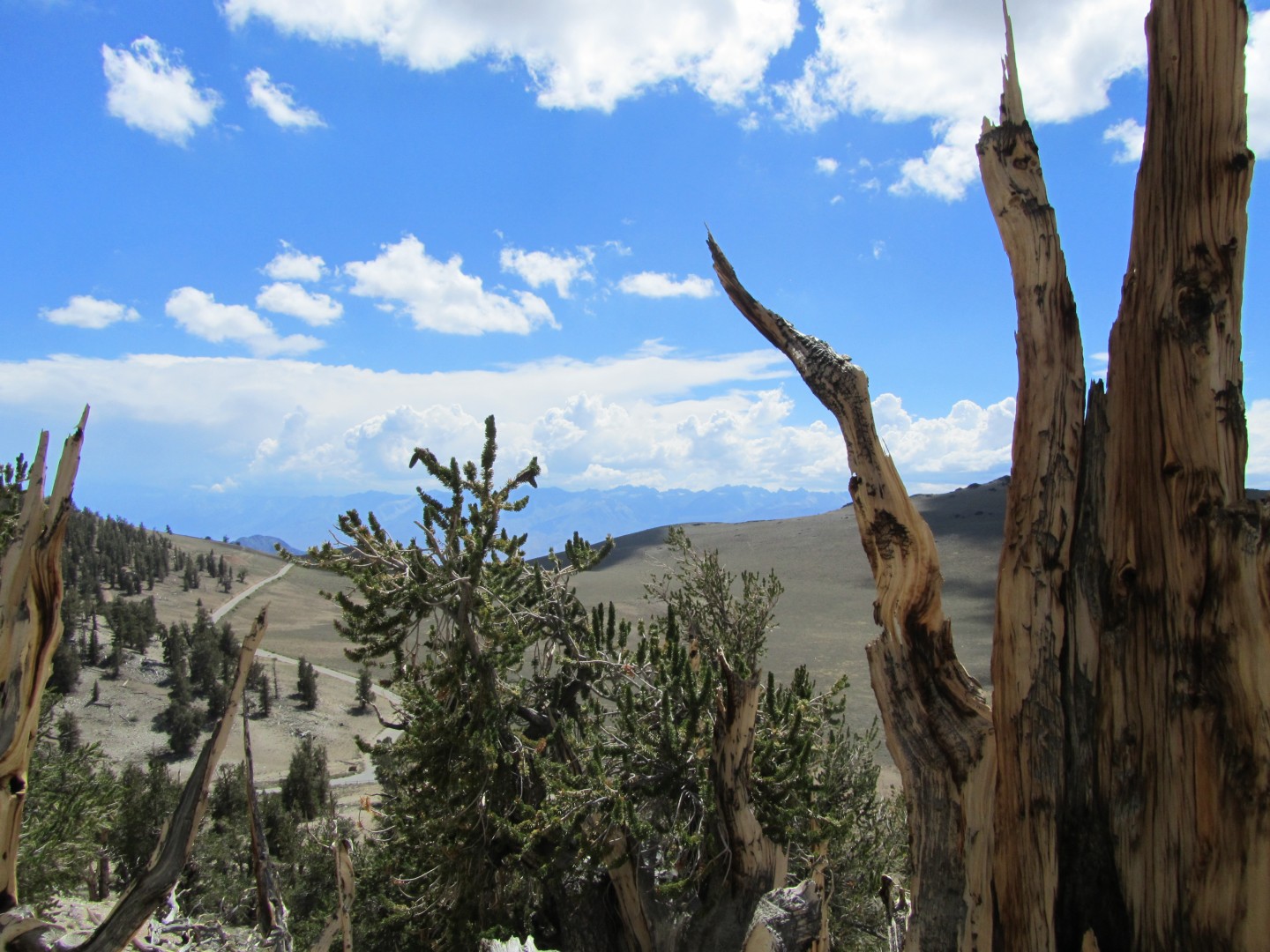
The approach to the bristlecones is
interesting. You drive well above the treeline for miles, then
round a bend and see a small, isolated forest - the Shulman Grove -
about half a mile ahead. The parking lot had perhaps a dozen
cars. The silence was broken only by the birdsong and the sound
of a gentle breeze blowing through the trees. I went into the
visitor center and bought a teeshirt, then hiked the short and easy
Discovery Trail. I met a few people early on, but then had the
trail, bristlecones, and mountain all
to myself. It was so quiet you could here the cars drive up from
a mile away.
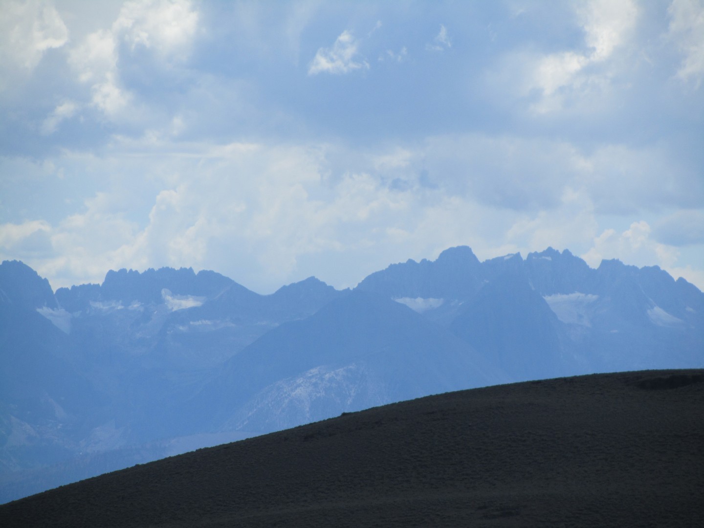
Glaciers in the Sierra across Owens Valley
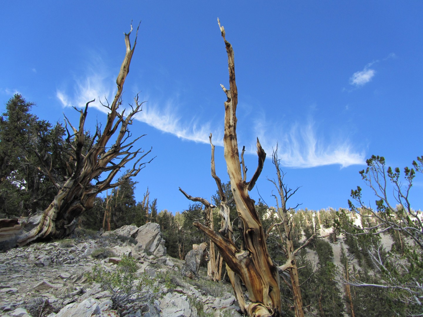
This cloud reminded me of the 'energy ribbon' in the movie Star Trek: Generations
I spent perhaps an hour on the
trail before driving
back down the mountain and south to Lone Pine.
I made it to the visitor center at 4:45pm. They had already placed my permit in the box out front, but they simply gave me a new one. They were closing for the day so I couldn't linger long, but I was extremely relieved to have the permit in hand. They also give every hiker a 'swag bag' in case you have to use the non-existent 'facilities' on the mountain - years ago they removed the outhouses from the camp and the summit to protect the environment.
Lone Pine, like most
towns in Owens Valley, has essentially two kinds of stores - restaurants and sporting good stores. While driving
slowerly through town evaluating my dinner options it started pouring
and hailing - an absolute deluge. I parked on a sidestreet under
a large tree to try to protect the car from the hail. The rain
let up after 10 minutes or so.
For dinner I selected Margie's Merry-Go-Round, a very unusual place built in the 50s to look like a merry go round that features Chinese food with a smaller American menu. I was the only diner inside. I quickly heard from the waiter and his girlfriend about the blackout last night - their restaurant was the only one in town that decided to stay open, but they worked their butts off and nodody tipped them because they were upset at the lack of power and minimal food choices. Once the power gave out, they couldn't prepare Chinese food anymore. I didn't want a steak or Chinese food, which left enchiladas as one fo the few remaining menu options. It wasn't the best Mexican food I'd ever had, but it was ok. As they handed me the check the power gave out. Fortunately I had just enough cash to pay with exact change and even leave a tip, so I didn't have to wait around for the power to come back on to try to use my credit card.
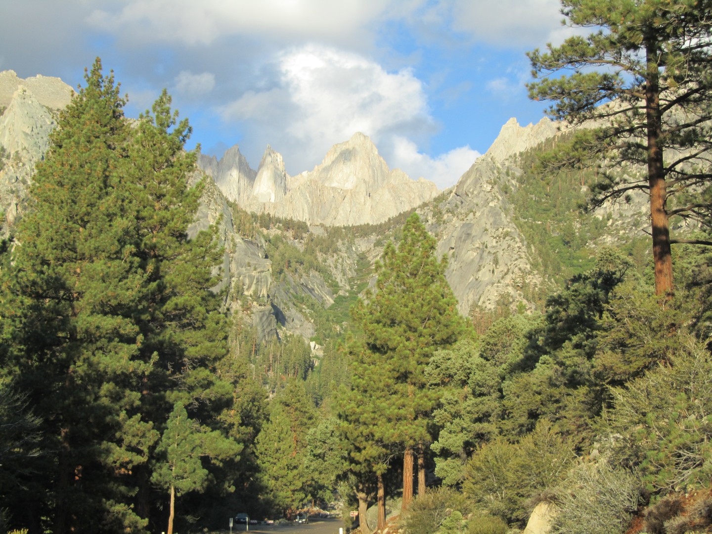
I drove up Whitney Portal Road,
stopped briefly at the Alamaba Hills. The views were
amazing. Eventually I found my campsite, unforgettable number
39. I selected it in the spring because it was the most isolated. The
parking spot for 39 is about 100 feet from the campsite itself - you
either hike down a very steep embankment, or you hike down the
streambed that runs through the middle of the campsite.
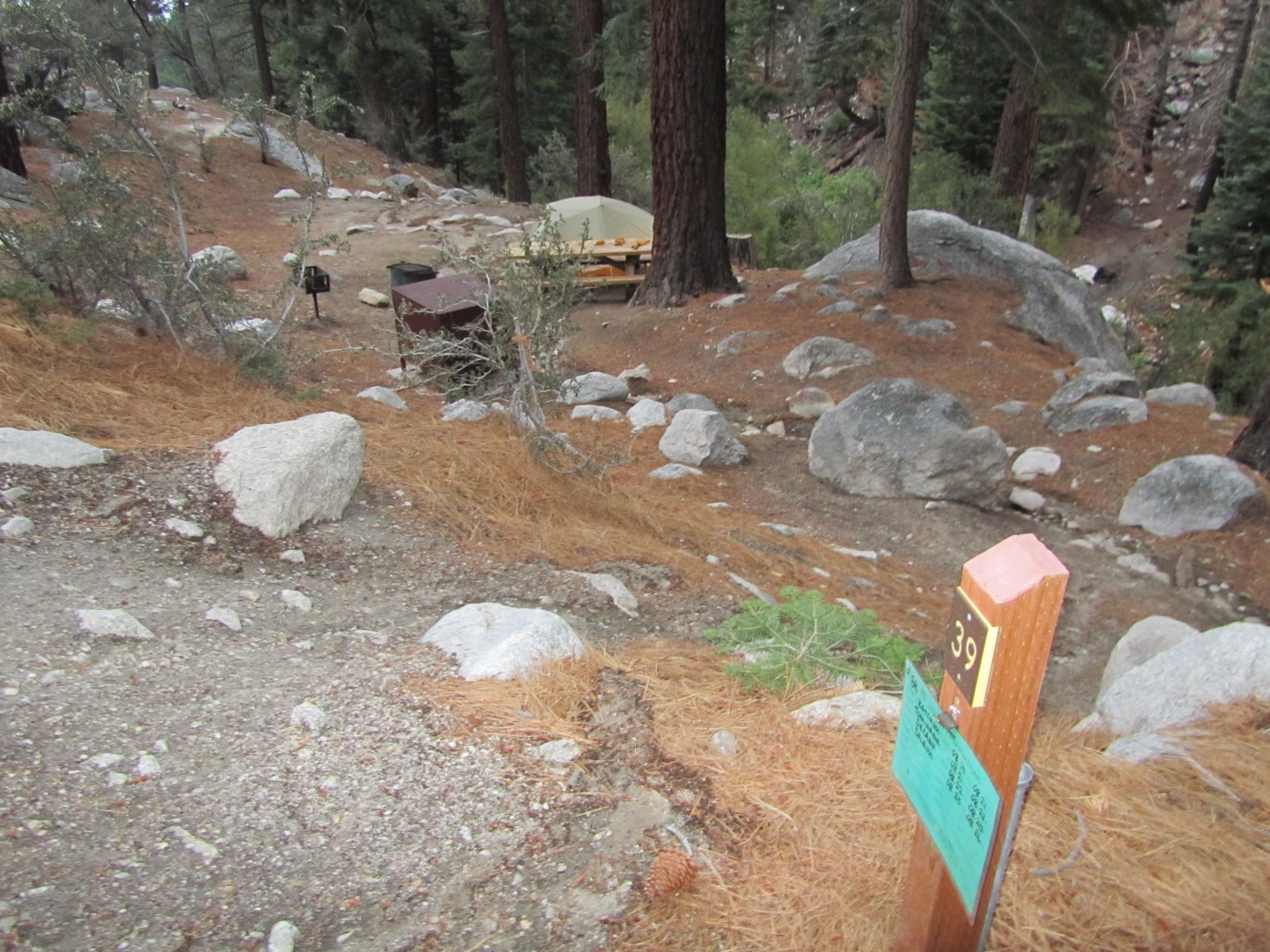
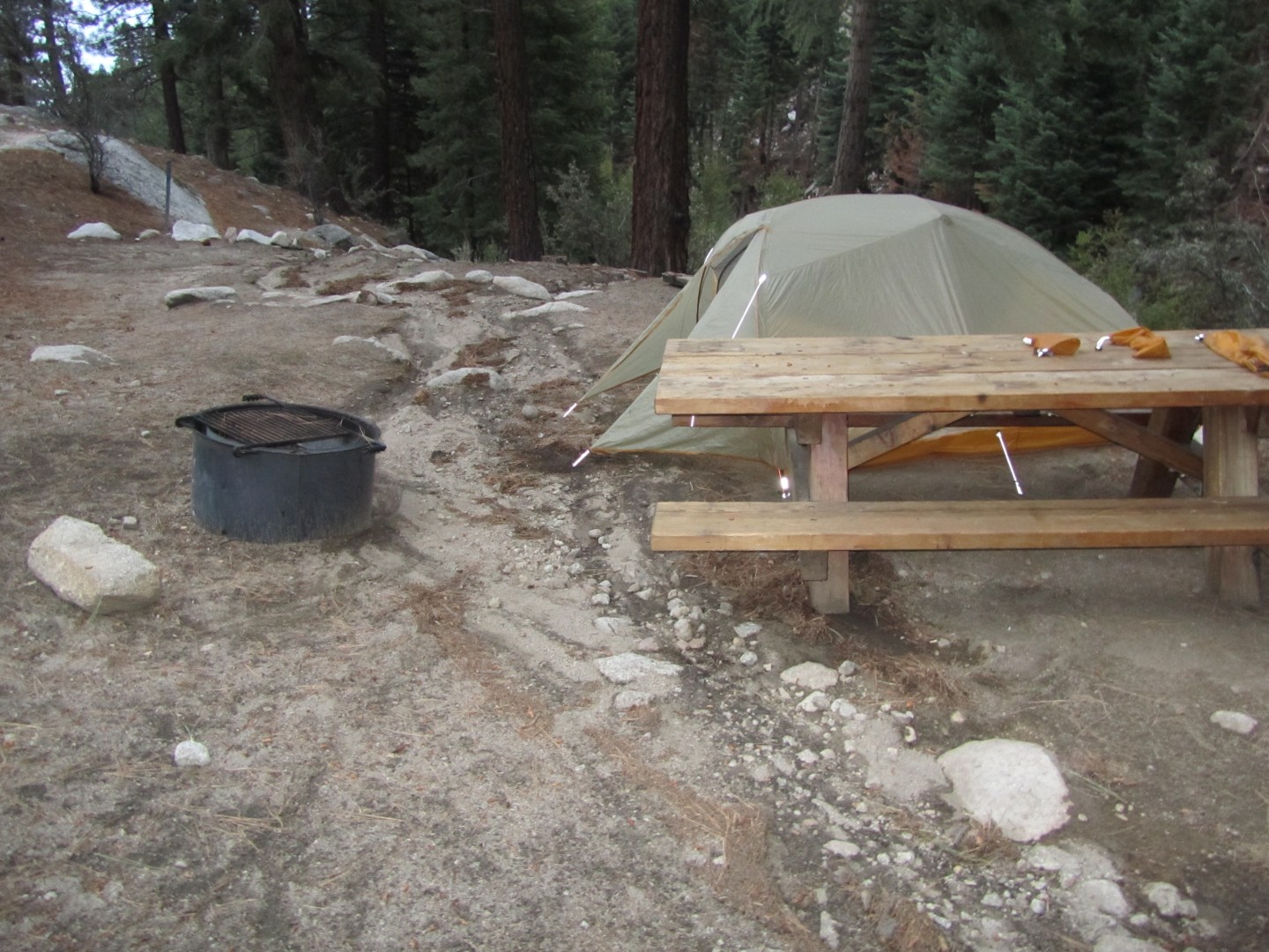
Whitney Portal
Campsite 39
Note the river running through it, surrounded by rocks on either side
I pitched my tent in the only remotely flat spot and
hoped for the best. I drove up the road to check out the store
and find the trailhead, then went to bed.
I woke up around 3:30am and told myself I had to be crazy to get out of my warm sleeping bag in the freezing cold and start hiking in the pitch black. In the dark I dressed for the hike, and I took everything out of my tent since I was quite concerned it would flood in my absence. I drove about a mile up the road, found a place to park, and started hiking at 4:23am. I was a little surprised that I was alone - I assumed I would have company. I cross a few streams in the dark. It was nearly an hour into my hike before I saw another person coming down the trail. I could not figure out why anyone would come down the trail at that time of day. The second person I saw was coming downhill as well.
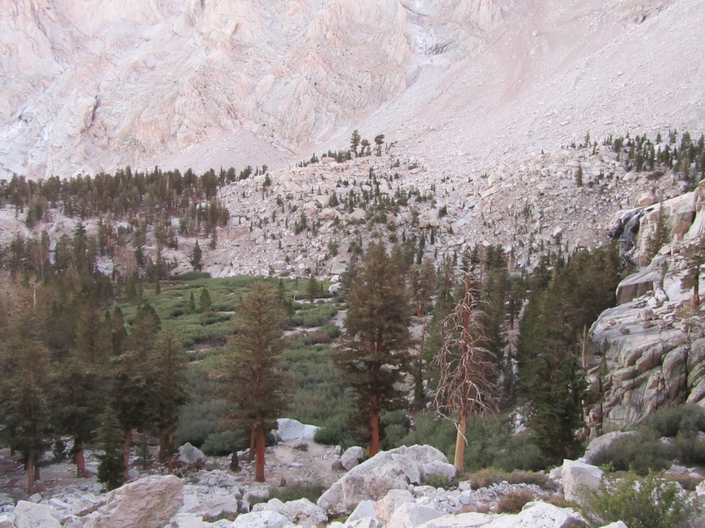
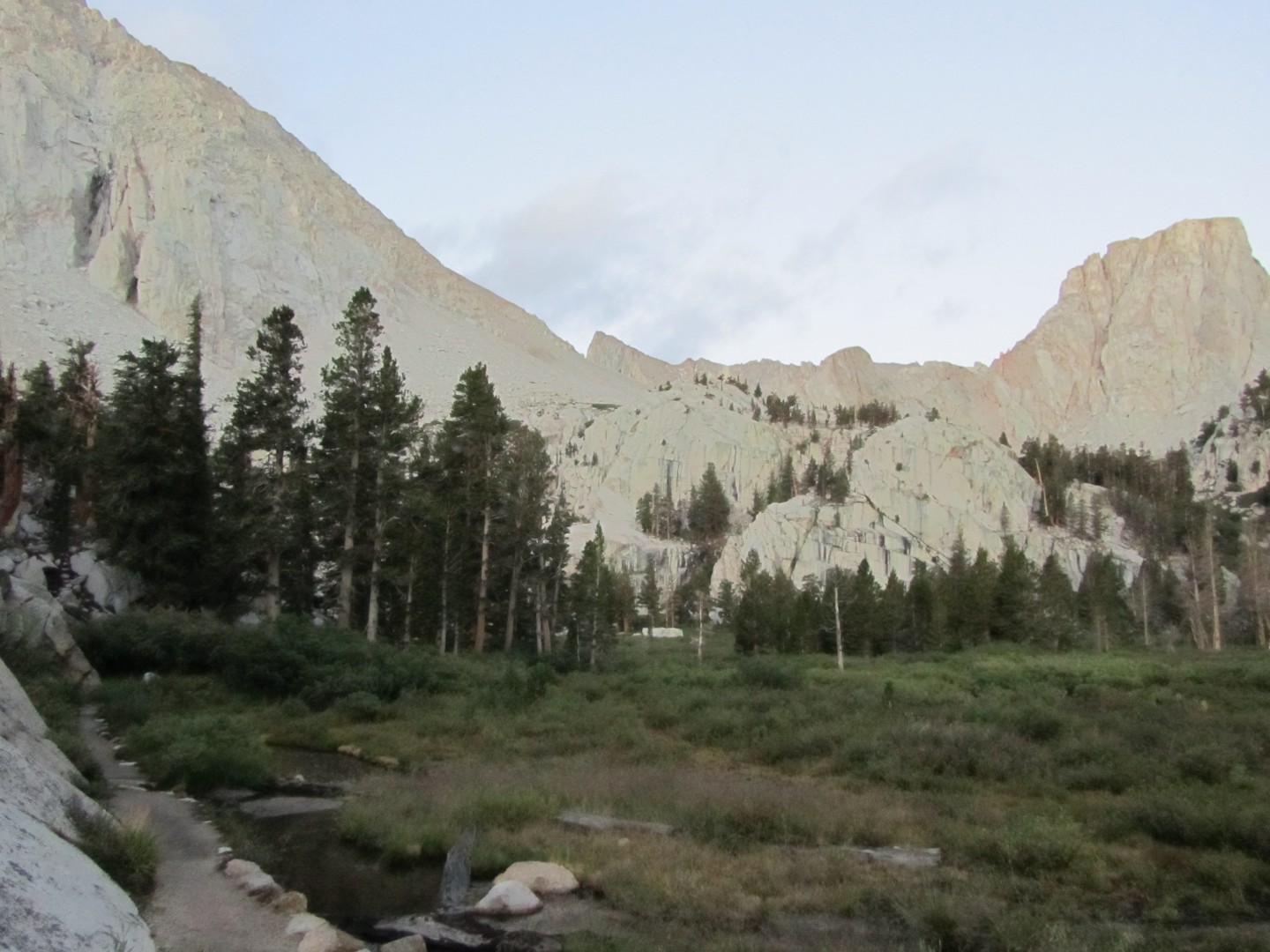
I arrived at Outpost
Camp at daybreak. There were about a dozen tents in a large area,
and a few people were just getting up and getting ready to hike.
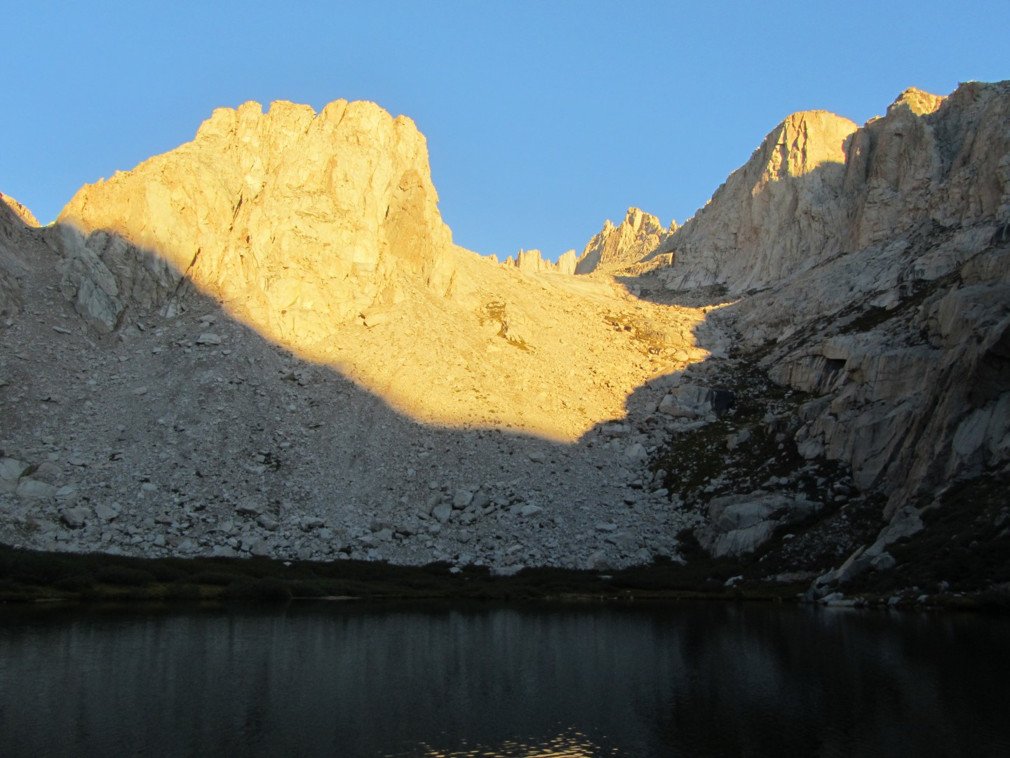
Click
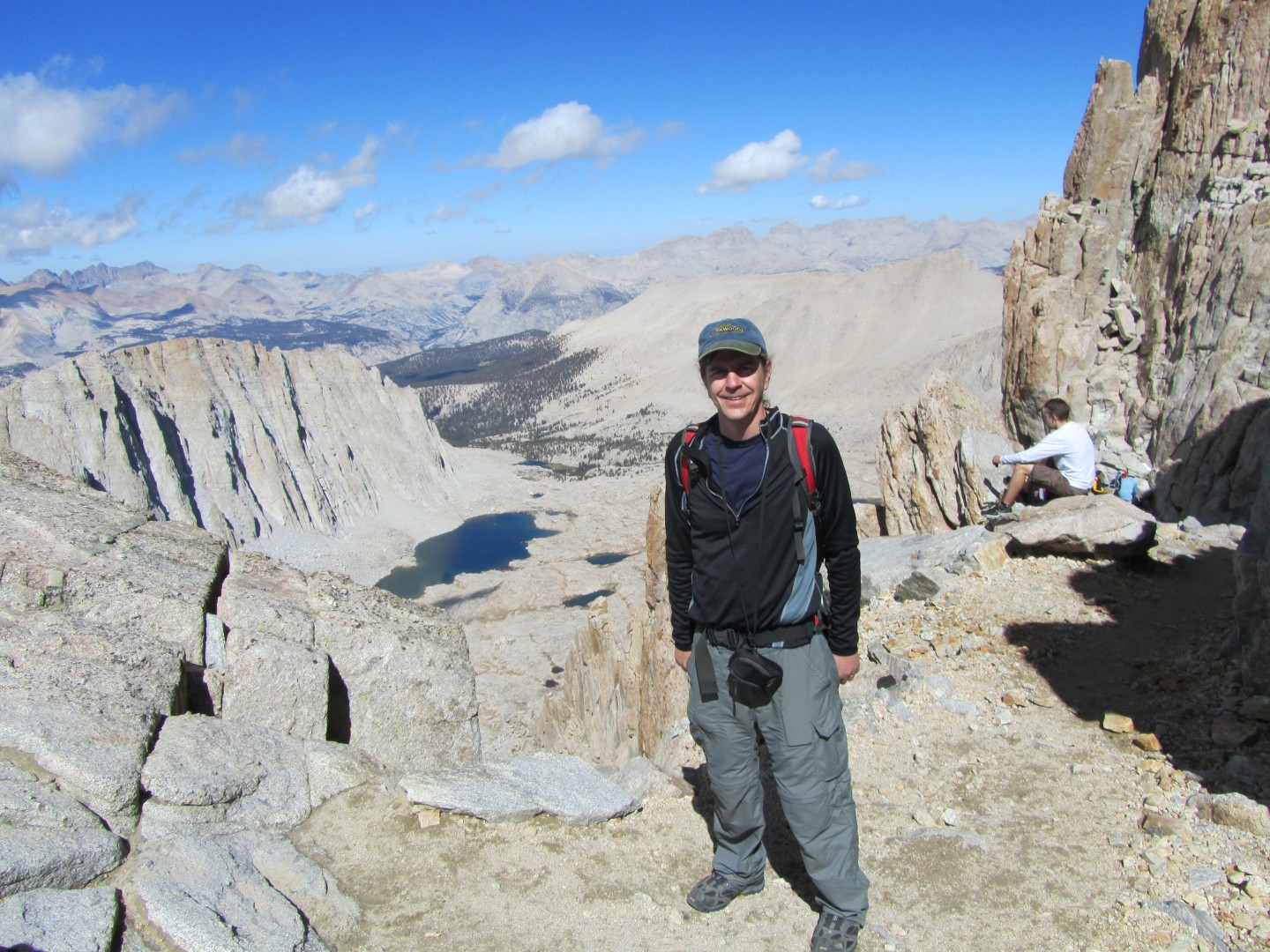
here for a great panorama of The view from Trail Camp.
I spent perhaps 10-15 minutes
at the lake at Trail camp taking pictures and refilling my Camelbak
using my SteriPen.
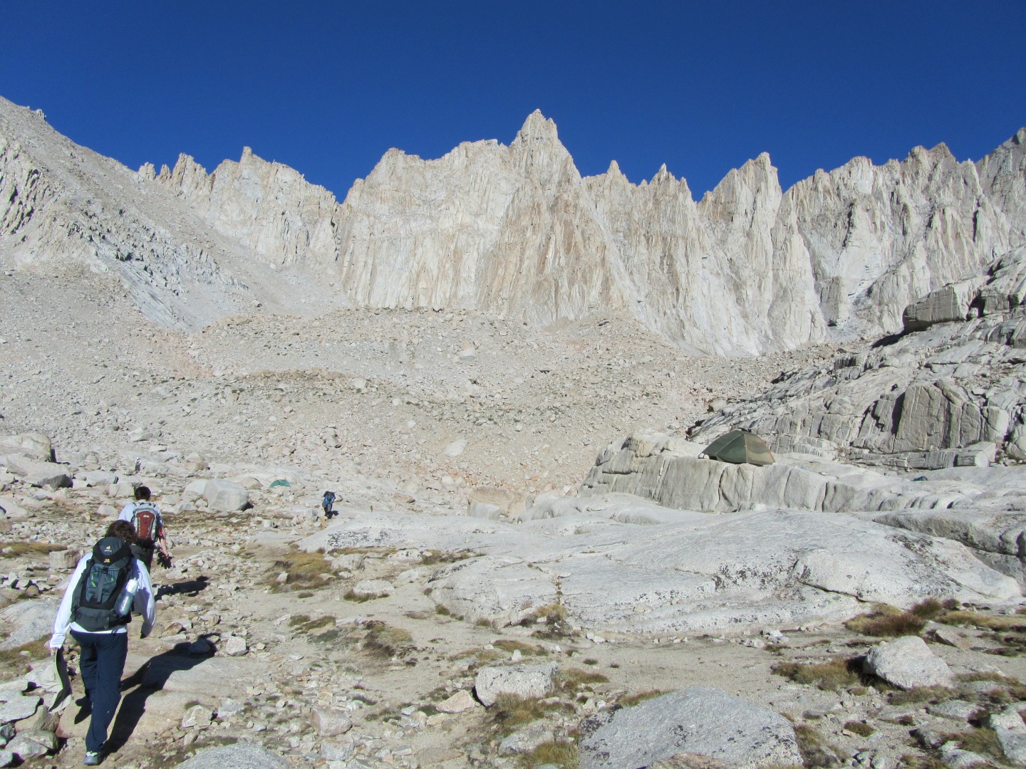
I was not looking forward to the infamous 99 switchbacks I was fast
approaching.
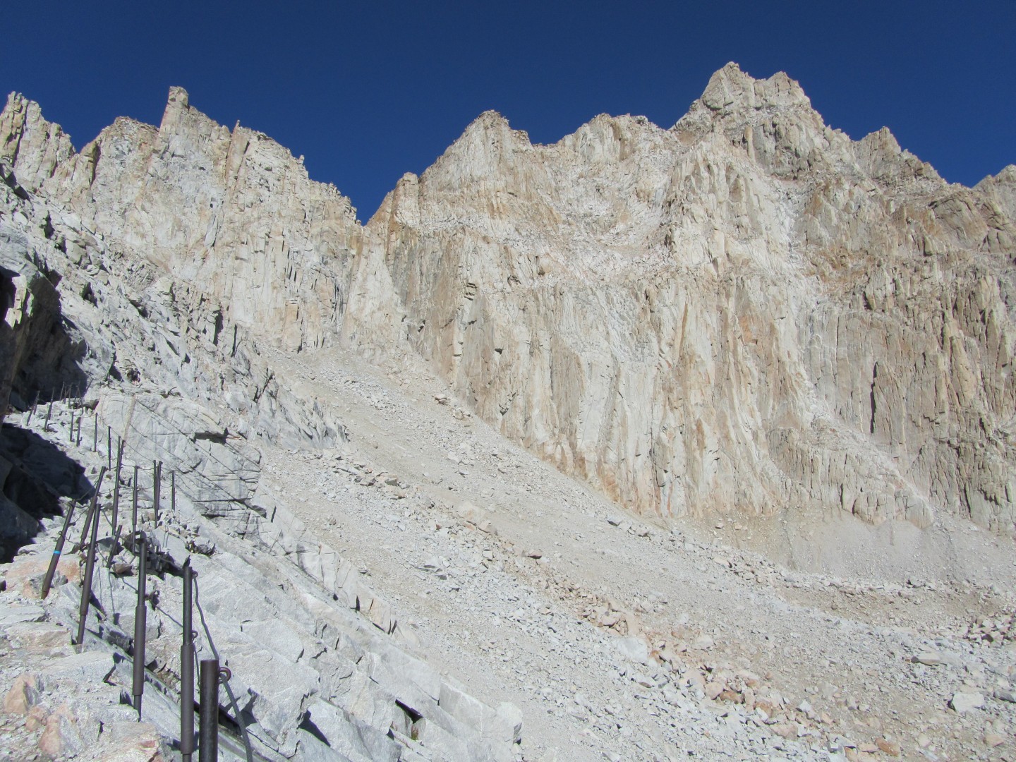
Perhaps a quarter of the way up the 99 switchbacks
Mt Muir is on the right
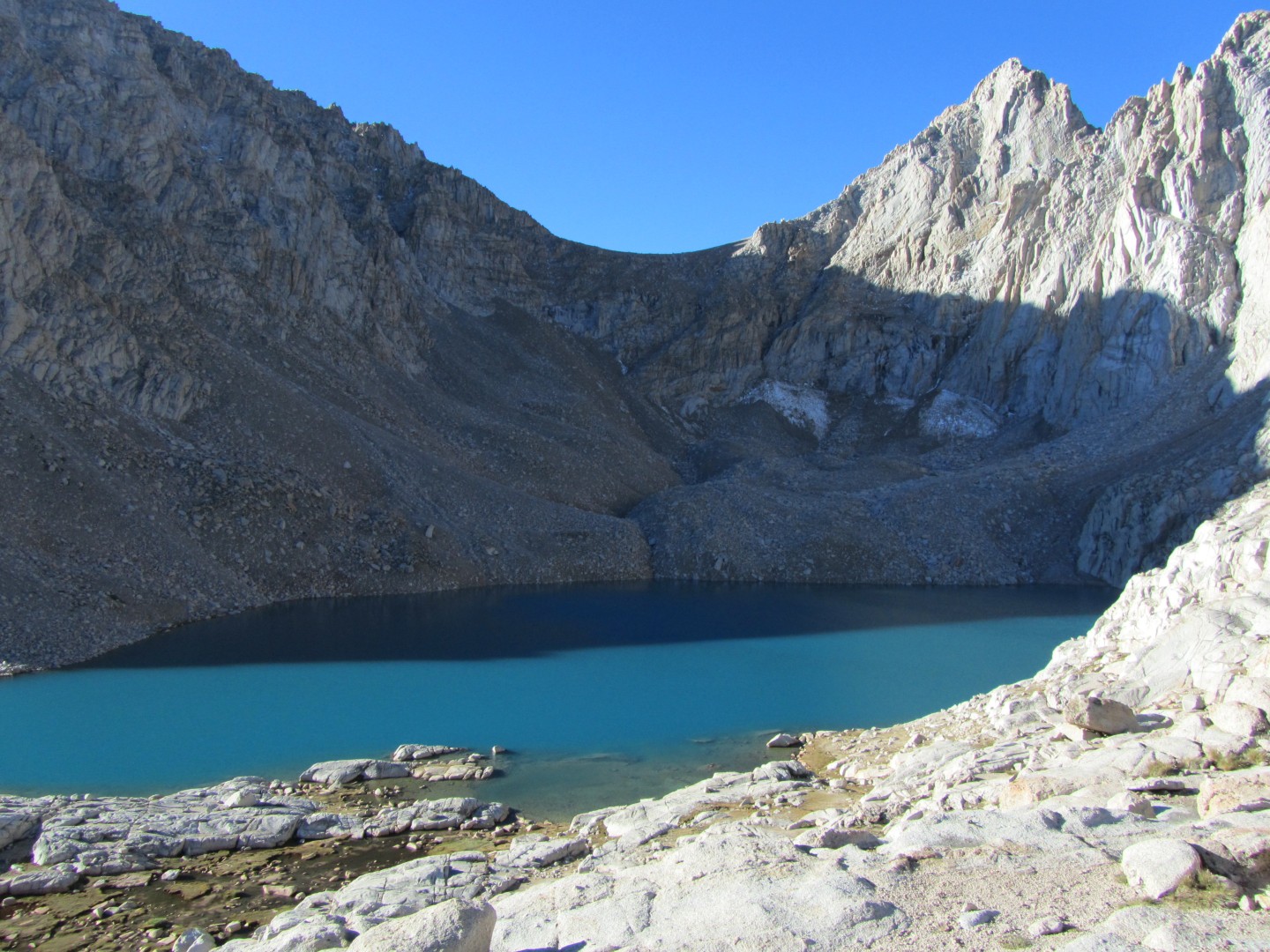
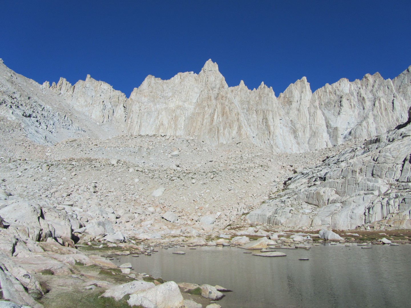
Trail Camp lake to the left, Consultation Lake to the right.
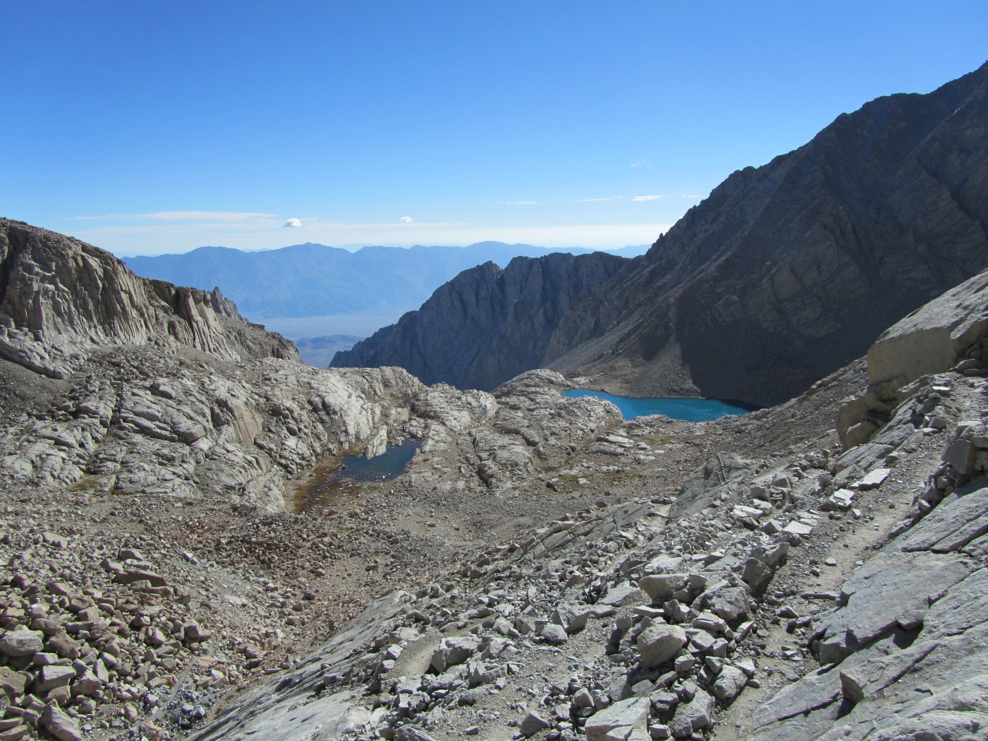
I'm most of the way up the 99 switchbacks now
This is still looking east with Owens Valley in the background.
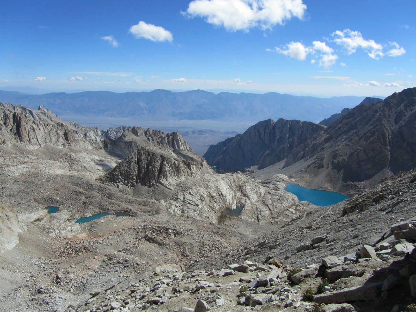
Trail Crest, looking west - elevation 13,646 feet
The Hitchcock Lakes are behind me
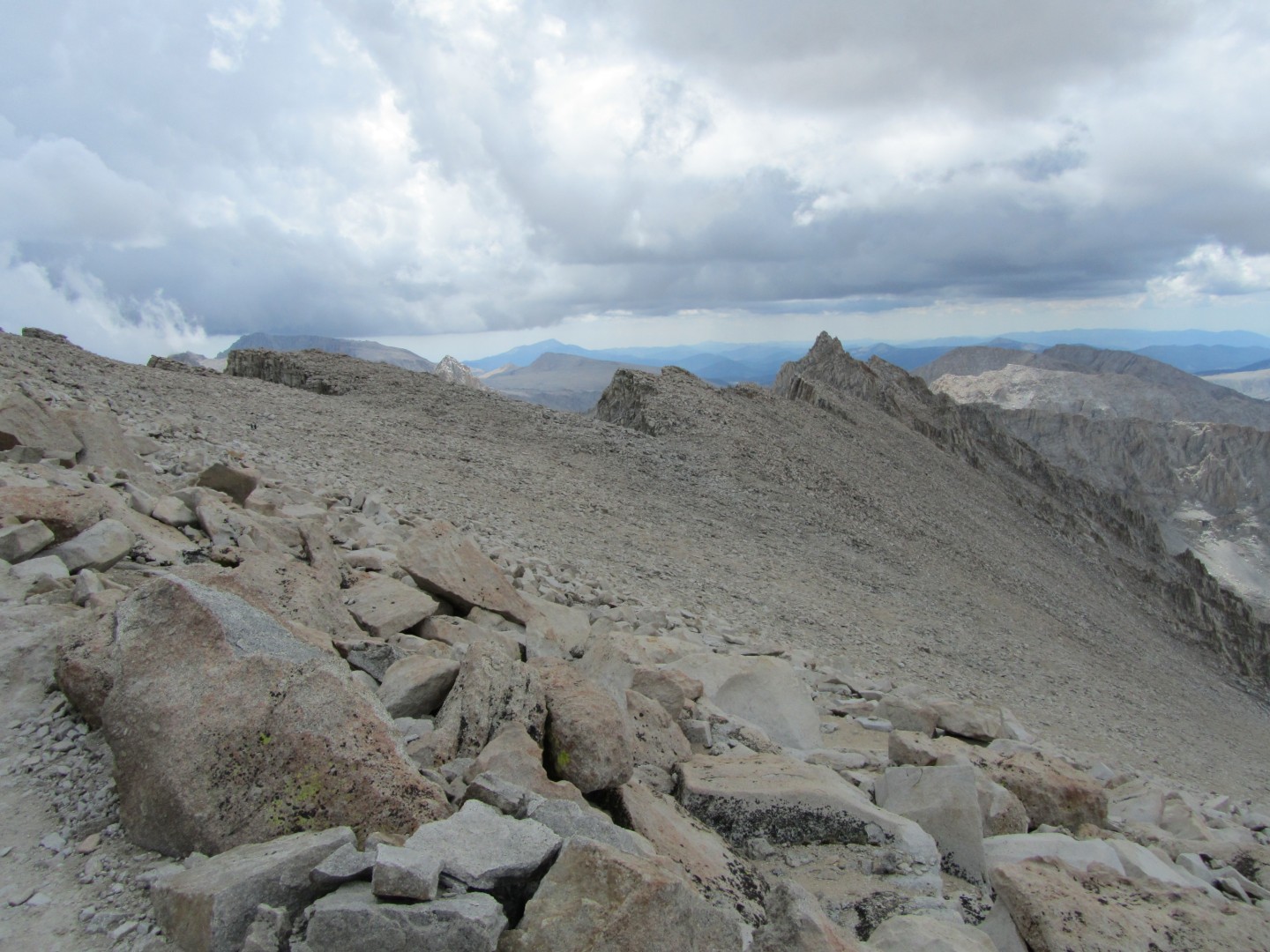
Now I get to hike on the east side of the crest.
I have to hike another two miles north towards Whitney
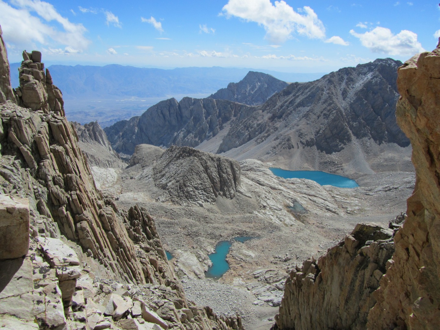
The ridgeline is spiked with numerous peaks. Occasionally the
trail, which lies west of the ridgeline, got close to a gap in the
peaks. I climbed up 10 feet or so to see what I could see in the
gap. I was treated to a jaw dropping view looking east.
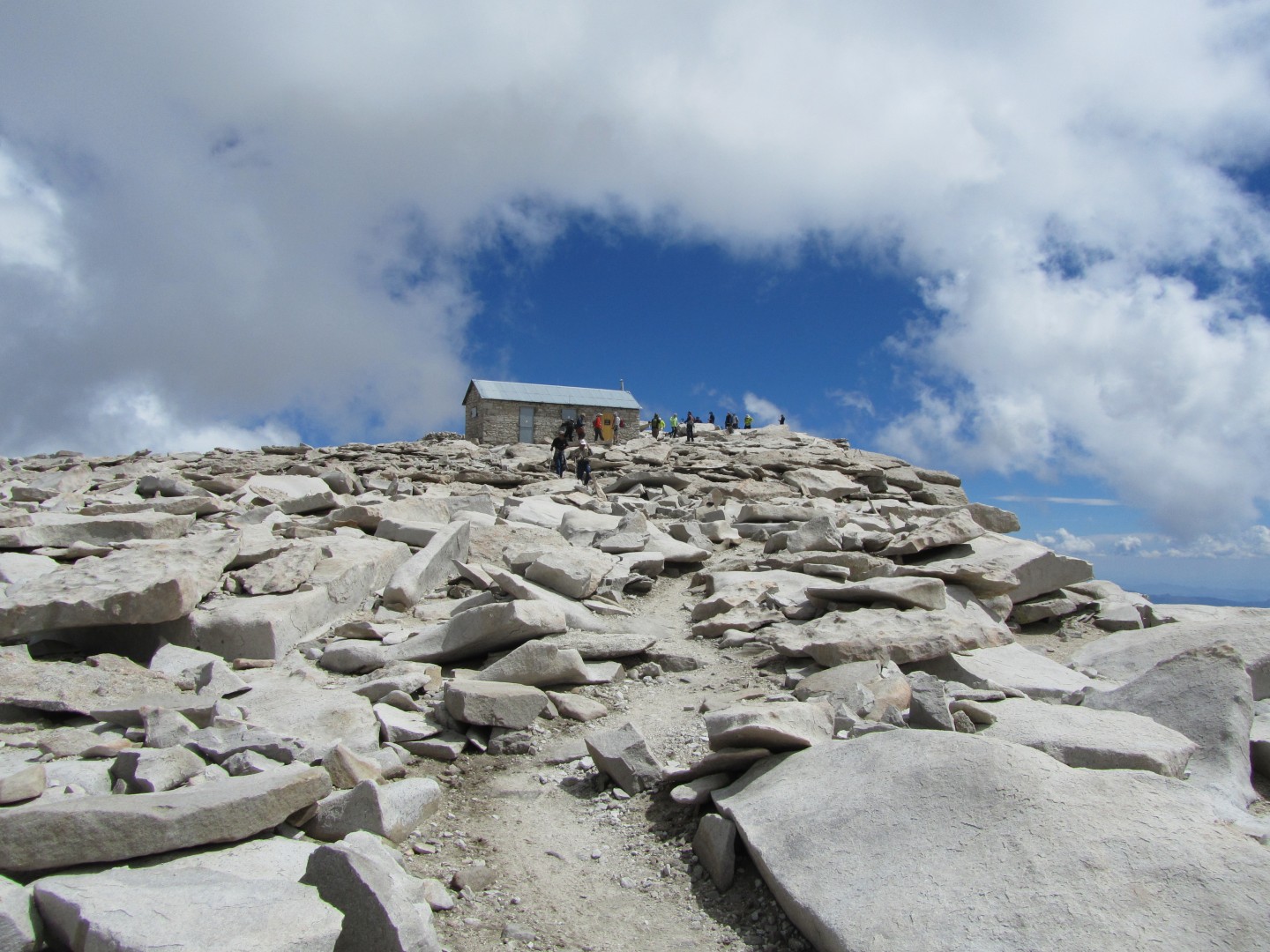
The trail to between trail crest and Whitney seemed to take
forever. Finally I approached the summit.