| home |
Glacier 2008 |
| Previous Saturday August 9, 2008 Day 15 - Many Glacier to Apgar |
Sunday August 10, 2008 |
Next |
The sunrise was even more fantastic than last night's sunset. I waited at Apgar for the first shuttle, which was supposed to arrive just after 7am. I didn't want to sit around at the Loop trailhead waiting for a shuttle that wasn't coming. The shuttle arrived on time, so I started driving.
I passed the shuttle at the first shuttle stop, and it took me about 35 minutes to drive to the Loop trailhead. Another couple and a single woman arrived just after I did. I couple of guys in a VW van had set up their tent in the parking lot and camped overnight. The shuttle arrived right on time, but it only had 2 seats open. The couple graciously let the single woman and me take the 2 seats - the next shuttle was supposed to arrive in 15 minutes.
We crawled up the mountain and listened to the talkative driver (who not surprisingly drives a school bus during the year). We got to wait at least 10 minutes for construction, and finally arrived at Logan Pass at around 8:30.
The Highline Trail is in the shade of the Garden Wall all morning long. The wind was howling over the pass, and it was chilly - perhaps in the low 50s without the wind chill. I was wearing jeans, a t-shirt, and a sweatshirt. I headed out across on the trail walking quickly to keep warm (ok, I always walk quickly, but it wasn't really an option now). The trail quickly encounters a rock cliff - the trail is perhaps 3 to 5 feet wide, and it's a straight drop a hundred feet or so onto the Going to the Sun road below. There's a chain bolted to the rock face to use as a handrail. Anyone with a fear of heights would have a serious problem with this trail, and in wet weather I think anyone would have a problem with it. Jeff's family told me how they encountered a family of mountain goats on this part of the trail, and they somehow managed to get between a kid and its mother, making for a lengthy tense standoff.
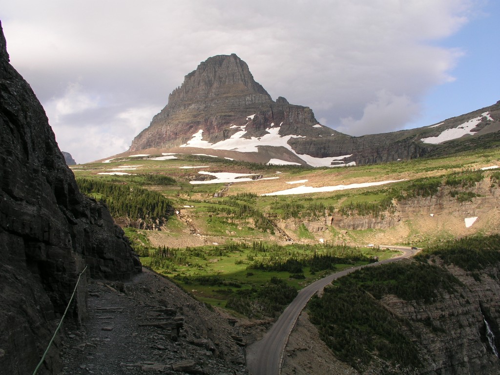
The
Highline Trail, looking back at Logan Pass.
Notice the narrow trail and steep dropoff
Birdwoman Falls
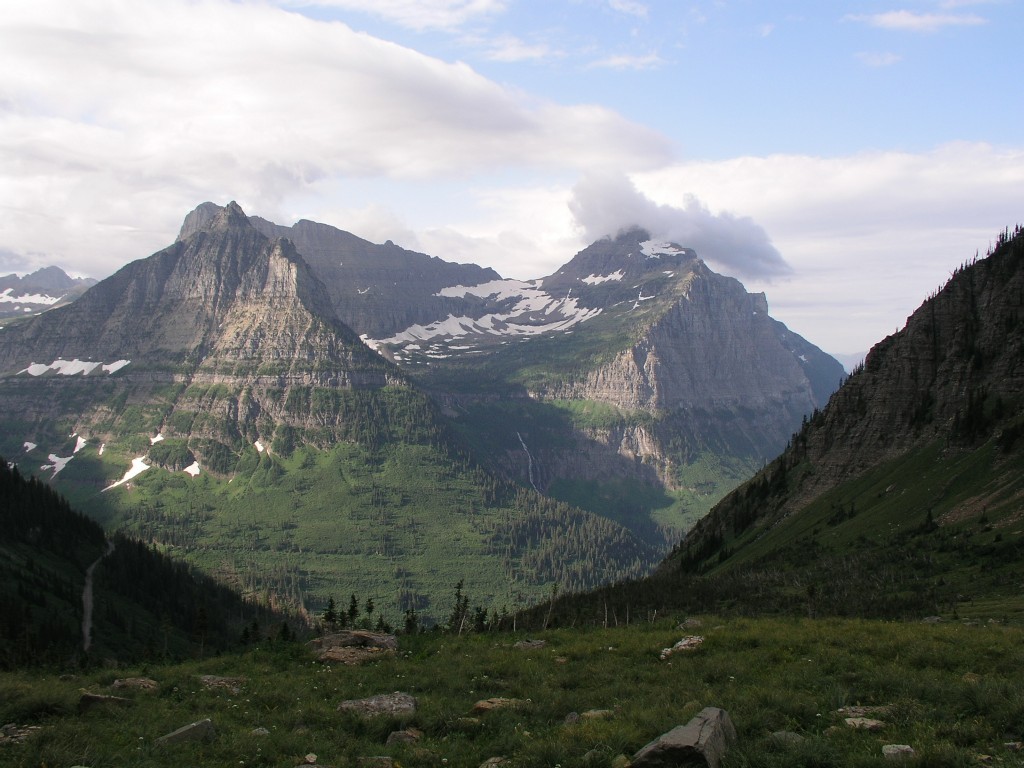
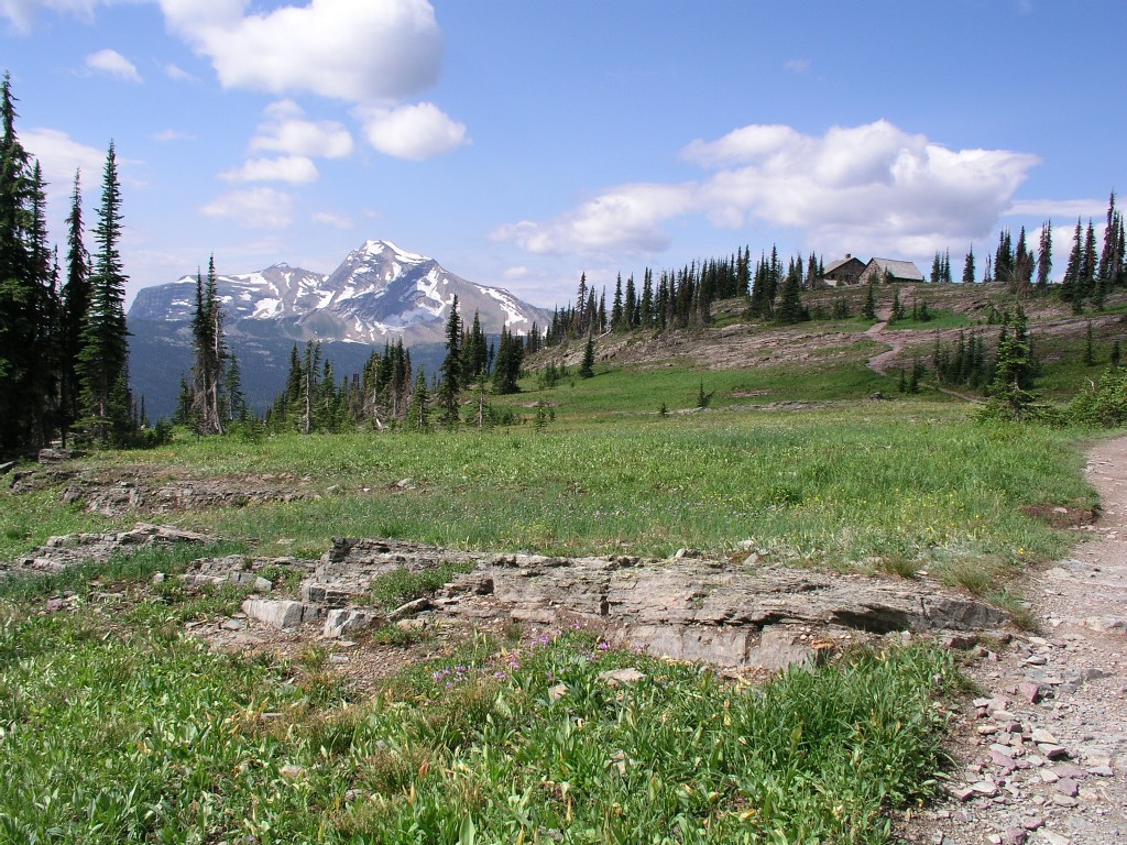
After a couple of miles the trail makes a single switchback over the Weeping Wall and passes to the next 'valley'. I saw a couple ahead of me on the switchback - they were perhaps 10-15 minutes ahead of me. The views get better and better as you get away from Mount Oberlin.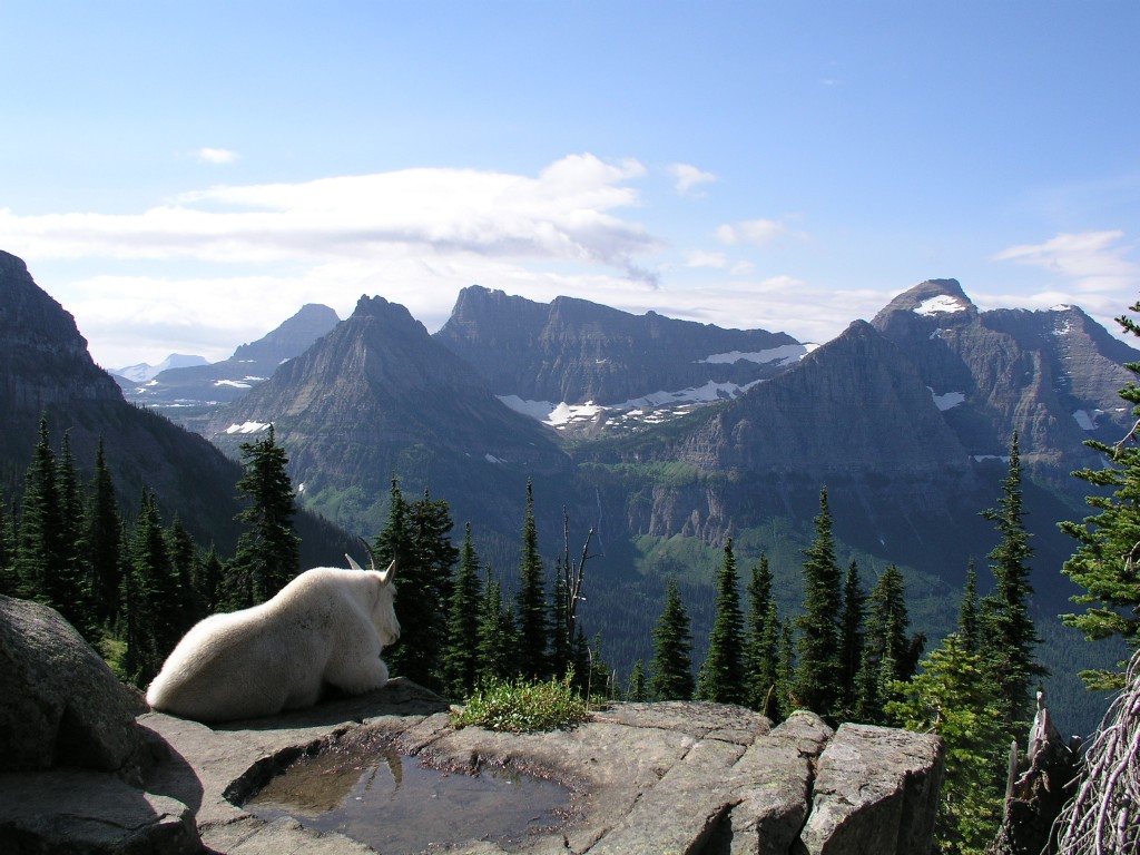
Mountain Goat and Birdwoman Falls
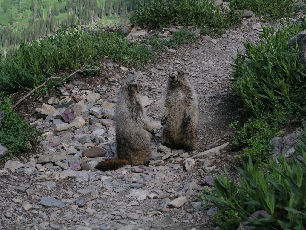
I found three young marmots
playing in the middle of the trail.
They were so involved
with each other they didn't notice me until I was right on top of them.
Yes, I'm aware that there are only two marmots in this picture.
At around 11am I reached the Chalet. The
Chalet complex has a few buildings - an outbuilding with around 8 tiny
bedrooms, a two story main building, and an outhouse. There's
no phone, no lights, no motorcar, just like Gilligan's
Island. A couple was eating lunch outside on the picnic
table. I'd had more than enough of the endless wind and
decided to take a break inside the Chalet. Inside it was
dark, as the only light came in through the windows. The main
room was perhaps 40' by 20'. A door led into the kitchen, and
a signup sheet telling each party their 15 minute window in the kitchen
was nearby. There was a modest stand with high priced
snacks. A family was playing cards. Two young
longhaired dudes who appeared to be in charge were sorting through
books. A refrigerator was labeled 'storage only' since there
was no power to keep anything cold. Another two guys who'd
been out in the bush for a while were eating a snack at the other end
of the room.
I stared at the pricelist behind the snackbar for a while and appeared
to find a bargain - hot chocolate for 25 cents. One of the
book sorting dudes came over and asked if I'd like anything.
I asked if there was any hot chocolate ready. He told me they
didn't have any way of heating anything up and that the sign was
misleading. Confused, I indicated I didn't need anything
else. A while later on the trail I realized that they were
selling individual packets of dry hot chocolate mix for 25
cents, The hermit like book sorting dude didn't enough
communication skills to relate that simple fact.
I wandered over toward the two guys who'd been in the bush for a
while. They showed me their route on the topo map
on the wall. Eventually I learned they'd been hiking for most
of a week and hadn't seen a single bear. Someone in the room
couldn't believe it - there were plenty of bears in this
park. I decided later that all the bears were on the
east side near the Many Glacier and Iceberg areas at the moment,
probably all chasing huckleberries.
After 15 minutes or so I left the Chalet and headed back out into the
wind. As I was walking out the door, the couple who'd
graciously let me have their seat on the first shuttle
arrived. They greeted me warmly, and I indicated they had to
be making great time. For only the second time today, I
started hiking uphill. The Highline trail is unusually flat
for a mountain trail, and had only made one very slight climb over the
ridge of the Weeping Wall.
The trail was relatively steep but not hideous. After perhaps
15 minutes it leveled out, and after a few more minutes I reached the
turnoff to the Swiftcurrent Lookout.
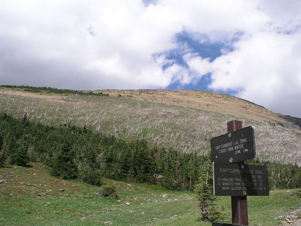
I could see a single hiker perhaps 5 minutes ahead of me on the trail up Swiftcurrent. This was reassuring - I didn't want to be the only one up there. There is a building on top of Swiftcurrent. It didn't look like an 1100; climb up. I paused for a minute, then continued up the trail. The ranger at Apgar indicated it would take perhaps 30 minutes to get up Swiftcurrent, then another 15 minutes down. Perhaps she could do it in that time, but I expected it would take me double that.
The trail made a few switchbacks through the forest, then a few more through a large stand of snags that had burned some years ago.
The wind picked up. As I rounded a corner on the west side of the mountain I was blasted by a fierce cold howling gale force wind. The temperature had to be no higher than 50, and the windchill must have been below 30. I was cold and hiked with my hands in my jeans pockets. Fortunately the wind died down somewhat as I worked my way back around the switchback.
Soon I was above the ridgeline. The switchbacks continued, and I was often met by the icy gale force blasts as I rounded the western corners of the switchbacks. I could see several hikers coming down the trail from the top. I was slowly gaining on the hiker in front of me, but it was taking much longer than I expected to get up the mountain. I was still way below the building on top of the mountain. I decided that my perception of the height of the mountain was warped by the size of the structure - it must have been much bigger than I thought it was.
When I met the hikers coming down, many of them had full winter gear on. At the moment it seemed appropriate, but it would have been drastic overkill for the rest of the day. Gloves would have been nice, though.Finally I reached the top. The wind was steady but thankfully not blasting. I took my camera out and started shooting. The views were amazing. I could see so much of the park from here. I had considered hiking all the way over to the Many Glacier Hotel - it didn't look to far away from here, but I resisted the urge to hike that far. Transportation back from the MGH would be problematic at best - they run a shuttle, but it costs money, I didn't know the schedule, and may be full, leaving me stranded. The lookout station on top is labeled 'Private Residence', and in a truly unfriendly move they even went so far as to rope off the steps to keep you away from the binocular clad hermit inside. I had been assuming the structure was open and had been looking forward to a brief respite from the biting wind and cold.
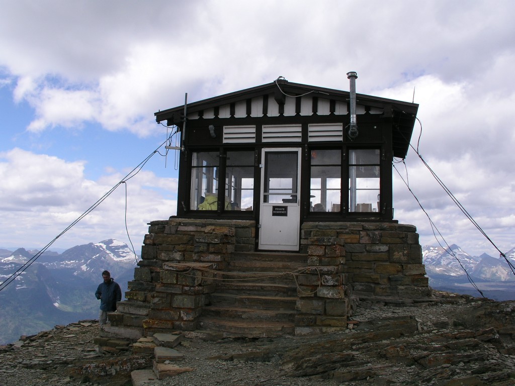
Swiftcurrent
Mountain Lookout
Notice the cables holding the top of the building to the mountain
I took perhaps a hundred pictures to make panoramic pictures. There were two men on top of the mountain with me, not counting the hermit in the lookout station. I took their pictures and they took mine.
Many Glacier Hotel is the in the background, pretty much in the center of the picture on the far side of the lake
Logan Pass and Birdwoman Falls from the top of Swiftcurrent Mountain
Click here for a panoramo from the top of Swiftcurrent Mountain
Click here for another panoramo from the top of Swiftcurrent Mountain
After perhaps 15 or 20 minutes on top my hand was red and numb from exposure while taking pictures. We all headed down about the same time, and I quickly left them behind. I warmed up relatively quickly once I was able to get my hands back in my pockets and once I started moving again.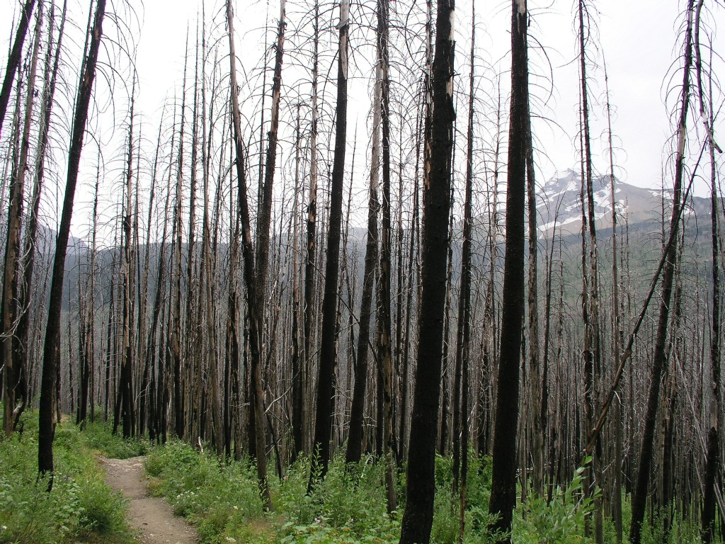
The trail now wound through another forest that had burned years ago. These snags were creaking back and forth in the wind, just like a Halloween soundtrack. It was quite surreal.
At around 3:30pm I saw a couple headed up the trail with minimal gear and clothing. I thought they needed their heads examined.
Finally
I saw several people on the trial and knew I was near the parking lot
where my warm windless minivan was waiting. It took a gruelingly slow
45 minutes to drive back to Apgar in heavy traffic. Later we ate our
last meal of the trip with Kathy's parents at West Glacier.
|
Previous |
Sunday August 10, 2008 |